2 to 8 people
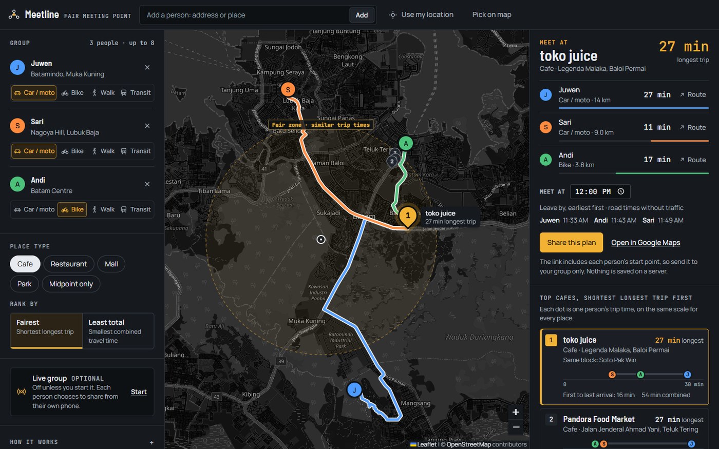
Add people by address search, Use my location, Pick on map, or a right-click or long-press on the map. Drag any marker to move someone.
Add two to eight people, and Meetline finds the cafe, restaurant, mall or park with the shortest longest trip, then draws a road route for each person.
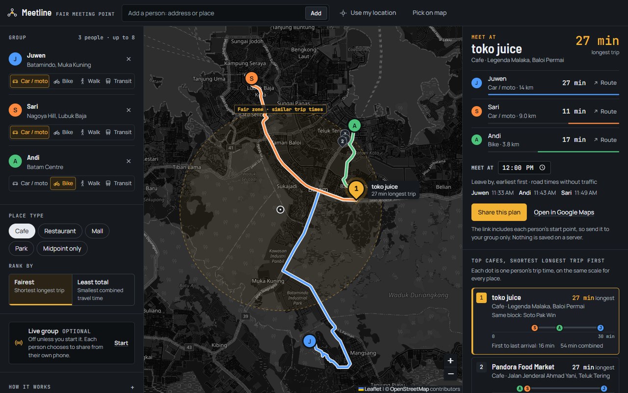
Find the fairest place for two or more people to meet, and the road route for each of them.
Add people by searching an address, using your current location, or tapping the map.
minimax centre of everyone's position (fairest) or geometric median (least total), computed on a local flat projection.
30 % of the group's spread, clamped to 0.7-6 km.
matching places from Photon / Nominatim inside that area, de-duplicated (same name within 60 m).
one OSRM table request per travel mode, person x candidate.
Add people by address search, Use my location, Pick on map, or a right-click or long-press on the map. Drag any marker to move someone.
Each person has their own travel mode, and their times come from the matching road profile.
Choose the kind of place, or ask for the exact fair point when you only need a spot on the map.
Fairest keeps the longest trip as short as possible. Least total keeps the sum of everyone's trips low.
Travel times come from OSRM road routing. If the router cannot be reached, Meetline falls back to straight-line estimates and says so.
Every ranked place shows one dot per person on a shared time axis, so you can see how balanced it is before reading a number.
Coloured routes on the map, a time per person, and a Route link that opens the same trip in Google Maps.
People, modes and the chosen place are encoded in the link. Send it and everyone opens the same plan.
From the README’s “Run it locally” section. Full options, requirements and troubleshooting are there too.
Open the README$ git clone https://github.com/juw12/meetline
$ cd meetline
$ python -m http.server 8080
# open http://localhost:8080/?demoStraight from the README, so you know what you're getting before you try it.
29 files in the repo · last updated 7 Nov 2026.
Browse the codeWeb, Leaflet, OSRM. You can try it in the browser with nothing to install.
The commands in the “Run it locally” box above come straight from the README. Paste them into a terminal; the README covers options and troubleshooting.
Locations stay in your browser (local storage) and in links you choose to share. To find places and routes, the app sends coordinates to the public OpenStreetMap services it uses: Photon and Nominatim for search, OSRM for routing, and OpenStreetMap for map tiles.
No public transport routing. No live location sharing between phones: each person's position is entered on one device, or sent around with the share link.
Not yet: it's marked “live” and still changing. The README always has the current state.
The source is public on GitHub under the MIT licence.
Juwen Lie, an R&D mechanical engineer in Batam, Indonesia, as an independent personal project.

Meet where nobody travels too long.